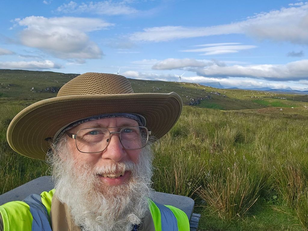
The clock is ticking on this pilgrimage as it winds down. I’m writing from a campground in Melvich on Wednesday. And, God willing (everything is God willing), I will walk into John O’Groats on Saturday morning.
The Scottish Highlands near Bettyhill
So many of my thoughts have been turning to some sort of summary, or gathering together of loose threads, or working out what I have learned from this 1,000 mile walk the length of the United Kingdom.
One thing about this trip, that I think I’ve mentioned before, is that there is no set path to follow. Everyone who does this LEJOG – Land’s End to John O’Groats – does it their own way.
And it’s clear I’m not a professional blogger. I get to the end of my walking day and writing/editing a lot isn’t the first thing on my mind.
Since I am trying mostly to “wild camp” – that we call “stealth camping” in the US – what is on my mind is to find a place to camp, to set up my tent so it’s quite inconspicuous, get something to eat, and go to bed. And sometimes that means waiting until it is closer to sunset.
Wild camping is technically illegal, I have read, but I’ve also read that campers are only very rarely told to move on. It would be a civil offense not criminal, but if one refused to move after the landowner told you to, it could escalate to criminal. Scotland is different.
But it’s hard, as far as I can tell, to figure out who the landowner is so you can ask permission.
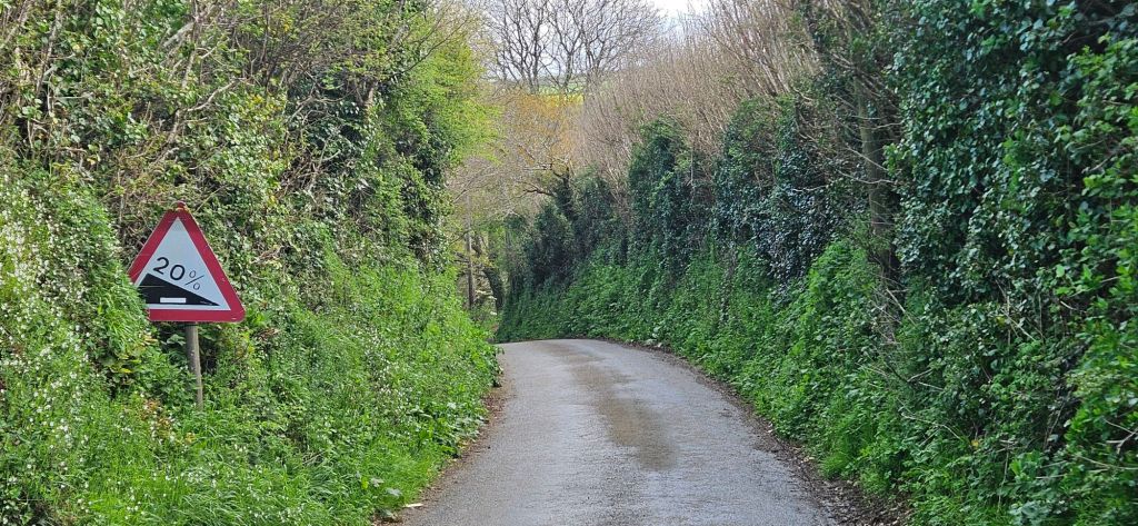
During the day when I’m out walking, I stick to the lanes and roads. No problems there, except that so many of the ones that my route uses are maybe a lane and a half wide. And since the Cornish farmers enjoyed building their hedges (now protected historic treasures) the sides of the roads are 6 to 10 foot high rugged plant matter usually with a core stone wall. (There’s some sort of sermon illustration in there.)
Narrow lane and hedges in Cornwall
Generally the hedges block the sun and wind. They also sometimes block a long ahead view of oncoming traffic. But since they also contain the sound, I hear the vehicles before we see each other. I’m wearing an orange safety vest on my left shoulder as a flag, too. I turn to the hedge and get as far to the side as I can. The drivers seem used to this.
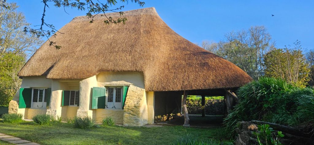
Anyway, I have been to several churches and want to share the prize so far: the Quaker Meetinghouse in Come for Good, built in 1707. Amazing thatched roof and, of course, simple interior.
Friends Meetinghouse, Come for Good, UK
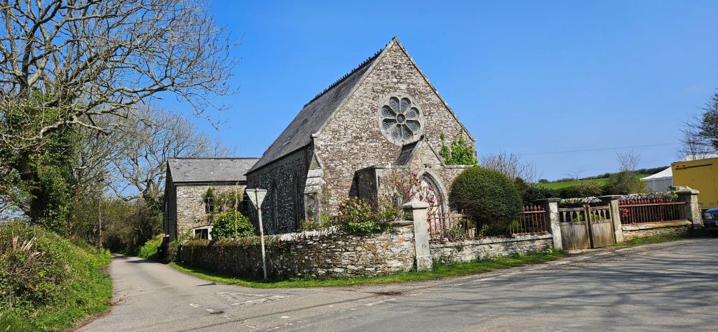
I’ve passed several “disused” church buildings, too. That is, no longer used by the Church as a place of worship. One is now a preschool. Another is a private home. And so on. Some are “listed” as historically significant.
I’ve also discovered that among the Anglicans (maybe others, too) there’s a movement or program to have “open churches” unlocked and available through the day to anyone who wants to come in for quiet and prayer. Or just to look at the stained glass. Ann suggested that a pilgrim might also ask whether he could spend the night as a place if sanctuary. If the opportunity arises, I’m intending to ask.
Disused church building now a private home in Cornwall, UK
OK, another issue with blogging from the pilgrim path is having a good enough connection. I am tenting tonight in a commercial campground for the first time. It’s next to the Lost Garden of Heligan, and was at the right place for me today when I needed to stop. But I’m not getting a strong enough signal to upload photos. Some other nights I have put up in a valley, so poor signal. Or out too far. Cornwall is pretty rural, though, so as I go north that may change (at least until the wilds of Scotland).
Which reminds me, my main map is from the Ordnance Survey (they’re like – and maybe better than – the USGS topographic maps in the US). They show all the wooded patches. And it only becomes clear on the ground that some of those patches are too steep to till so that’s why they were left in trees; or that they’re marshy; or that the scrub between the trees is imoenatrable; or that a particular wood is fenced off with a 6 foot tall fence topped with 2 strands of barbed wire. (Such a fence surprised me last night, so I had to pitch up in sight of a house.) I’m learning to be flexible.
Those are the kinds of things that God is working on with me do far. That, and not being able to walk as far in a day as I had hoped.
Among American long distance hikers there’s a thing – a real thing – called “Springer Fever.” It hits this time of year. Hard to avoid. Not that you’d necessarily want to. It’s this deep urge to go hiking again, to be back in Georgia on Springer Mountain (hence the name), starting another Appalachian Trail hike. Or, for me this year, walking church to church the length of Britain.
Okay, fine, the last posts explain what a LEJOG is, but why do it?
A goodly number of the people do this trek to raise funds for a charity. Those are the people who post and boost videos during their trip. LEJOGers who aren’t trying to reach more potential donors don’t have the same need to publicize their efforts. But there are other reasons to walk 1,000 miles.
I wrote yesterday about how I am planning on walking the cycle paths, small country lanes, quiet roads, and canal paths that are spelled out in the Richard Barrett book.
And, of course, I’m already figuring on customizing it.
Here’s the deal with planning your own LEJOG: after deciding that you’d like to try it, you need to figure out a route between the two ends. That’s right! Unlike the Appalachian Trail, this major trek is not blazed end-to-end. There isn’t one single “official” pathway. The whole ‘how do you get from here to there’ part is up to each individual trekker.
So, if you haven’t turned already to your atlas to see where those endpoints are, let me fill you in. Lands’ End is the southwesternmost point of mainland England. John o’Groats is the northeasternmost point of mainland Scotland. They’re roughly 800 miles apart, but you can’t walk there by that ‘as the crow flies’ straight line route. There’s too much water in between, for one thing.