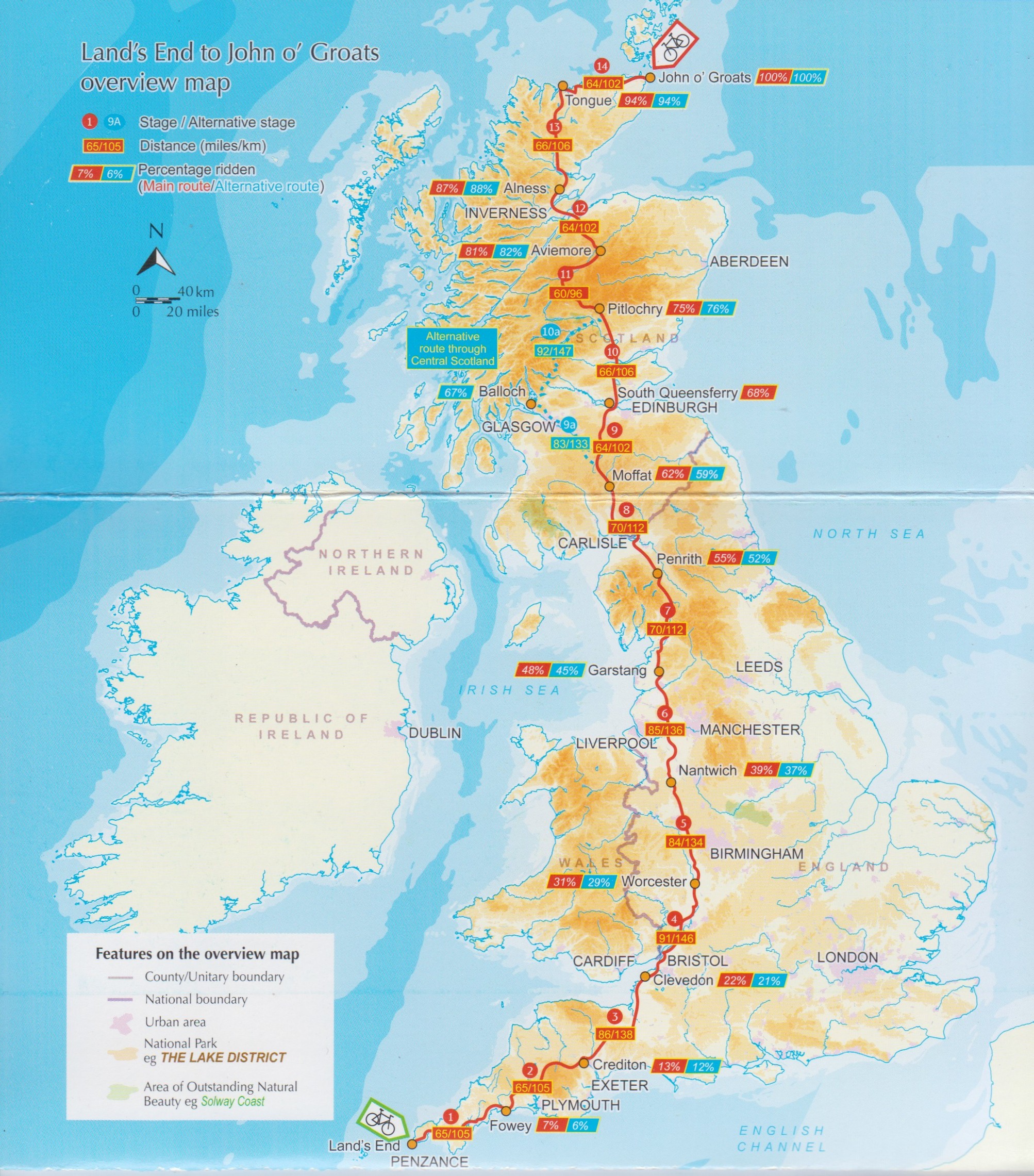
I have lifted this map from the inside front cover of Cycling Land’s End to John O’Groats: LEJOG end-to-end on quiet roads and traffic-free paths by Richard Barrett. 3rd edition. Kendal, Cumbria : Cicerone, ©2021. It shows pretty much the route I’m planning on walking northbound, except for the two diversions I’ve already mentioned: the Offa’s Dyke Path, and the Annandale Way.
You can approximate where Offa’s Dyke runs if you follow the border between Wales and England. That’s shown on the map between Bristol and Liverpool, running through the “W” of Worcester. Then the Annandale Way runs from a little bit above Carlisle (20 miles, actually) north to Moffat.
Aside from those two bits, you can use this map to estimate where I am when I report in. Note the percentages completed in the red/blue boxes when I’ll have gotten to the locales named at the orange dots. (For example at Fowey – near the bottom of the map – I will have completed 7% of the route.) And the distance between dots in miles/kilometers are the numbers in the red rectangles placed on the route itself. (So, again between Land’s End and Fowey it’s 65 miles or 105 kilometers.)